News Summary
St. Petersburg officials have initiated the Florida Seafloor Mapping Initiative to enhance understanding of coastal waters after recent hurricane damage. Led by Saildrone, the project aims to collect high-resolution seafloor data using advanced technology, which will aid in disaster preparedness against future hurricanes. The initiative is critical for developing effective response plans and strengthening the community’s resilience against climate-related events.
St. Petersburg’s Bold Move: Florida Seafloor Mapping Initiative Takes Off
In the sunny city of St. Petersburg, officials are ramping up efforts to tackle the fallout from recent hurricane damage. With the looming threat of storm surges, the local government is diving headfirst into a new initiative that promises to shine a light on the otherwise murky depths of Florida’s coastal waters. Enter the Florida Seafloor Mapping Initiative (FSMI), a visionary project that seeks to update and enhance our understanding of underwater landscapes around the state.
Saildrone Takes the Helm
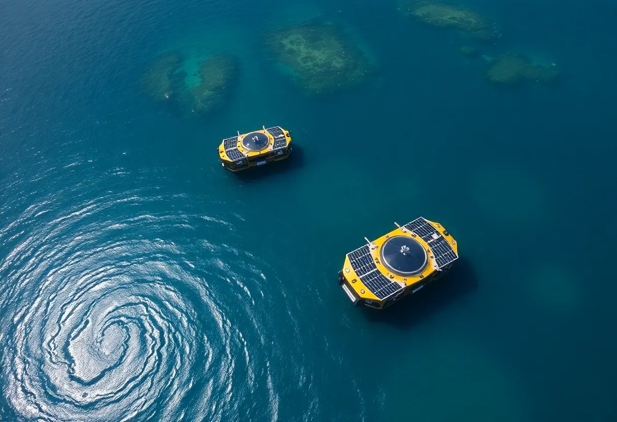
Leading the charge is Saildrone, an innovative maritime defense and oceanographic survey company. They’ve rolled out two sleek, 10-meter solar-powered uncrewed surface vehicles (USVs), whimsically named Saildrone Voyager. These state-of-the-art vessels have a singular mission: to meticulously map an impressive 2,817 square kilometers of Florida’s coastal waters, situated about 130 kilometers northwest of St. Petersburg. With the goal of acquiring high-resolution seafloor data by 2028, these technological wonders aim to replace outdated nautical charts and bolster our knowledge of the ocean floor.
Why This Matters
The new mapping venture is not just a matter of curiosity; it’s a crucial step toward fortifying Florida against future calamities. With the data gathered, scientists and emergency management teams can better understand the state’s vulnerabilities to hurricanes, ultimately enabling more effective response plans when disaster strikes. As noted by experts, being able to predict and prepare for storm surges is vital, especially in a state that feels the brunt of nature’s fury.
Tech on the High Seas
Saildrone’s cutting-edge USVs are packed with technology that makes them perfect for the job. They use NORBIT WINGHEAD i80s echo sounders to collect high-resolution mapping data, in addition to a suite of tools for maritime domain awareness, including radar, AIS, and cameras. This tech-savvy fleet marks the first deployment of Saildrone Voyagers from Tampa Bay, though similar deployments have previously supported the US Navy and specialized operations in the Caribbean. The excitement doesn’t stop there, as a follow-up deployment is already in the works for mid-April, concentrating on critical hurricane storm data collection. This upcoming mission is generously funded by the National Oceanic and Atmospheric Administration (NOAA).
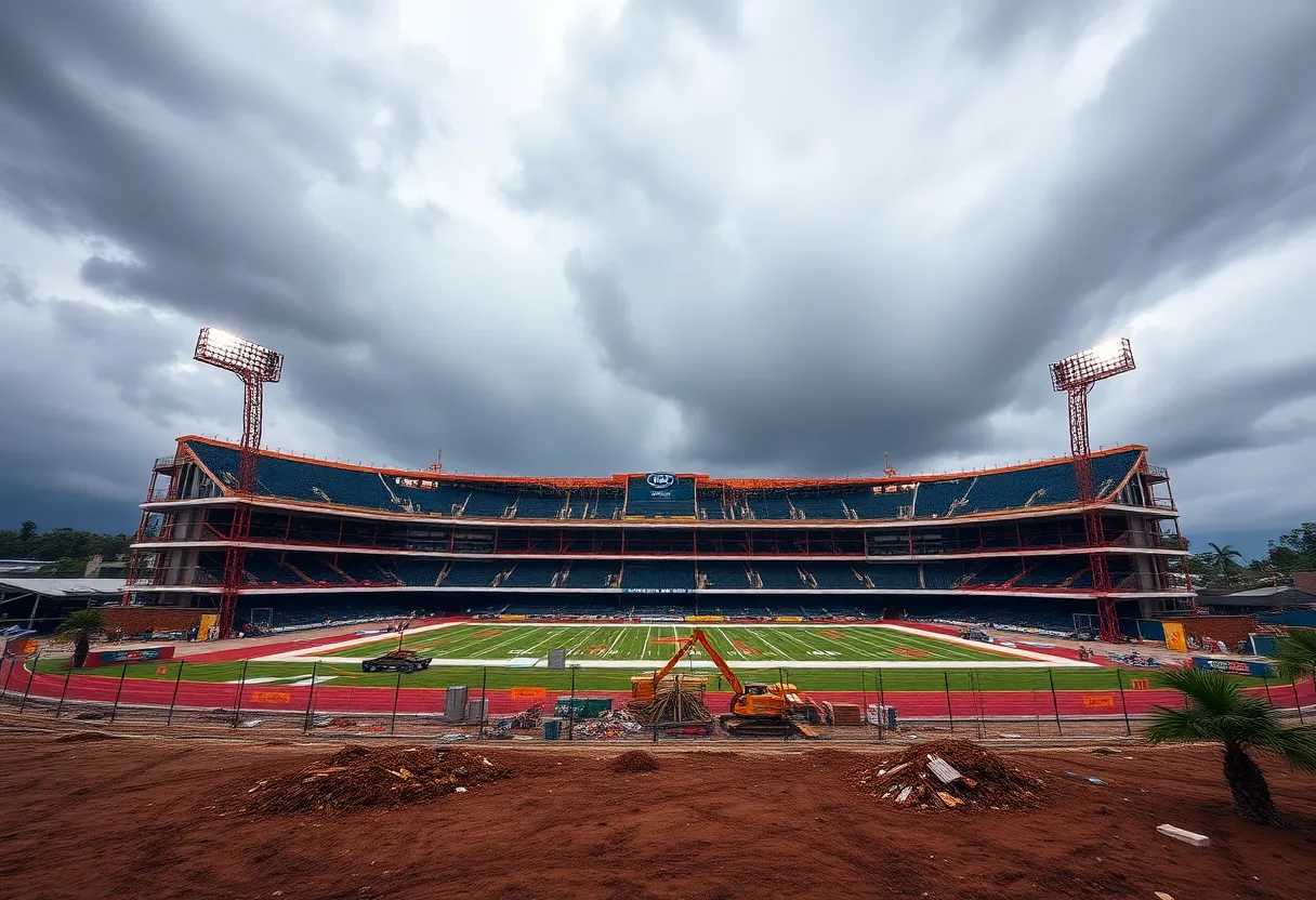
Facing Financial Storms
As St. Petersburg grapples with the aftermath of fierce storms, the economic ramifications are making headlines. The area has faced staggering financial impacts due to hurricanes, with Commissioner Kathleen Peters reporting damage estimates totaling around $2.434 billion following the devastation wrought by Hurricane Helene. A remarkable 86% of this figure has been attributed to this one storm, while Hurricane Milton also contributed to considerable residential damage. With worries persisting regarding the adequacy of damage assessments—particularly affecting vulnerable groups like seniors—there’s a growing call for increased funding to improve infrastructure and initiate beach renourishment projects.
A Community on Alert
The mood in the area is one of vigilance and determination. Major flooding and extensive damage from recent hurricanes have sparked discussions on how the region can improve its disaster preparedness. This is not just about repairing what was lost—it’s about building resilience for the future. St. Petersburg citizens are rallying together to create a safer, smarter community, one that learns from its experiences and faces the growing challenges of climate-related storms head-on.
As the Saildrone initiative unfolds, all eyes are on the horizon. The hope is that enhancing our understanding of Florida’s coastal ecosystem will not only support environmental efforts but also help shield the community from future storms. With technology and community spirit intertwined, St. Petersburg is charting a new course towards a more resilient future.
Deeper Dive: News & Info About This Topic
HERE Resources
New Ocean Mapping Project Launches Off Florida Coast
St. Petersburg School Gains New Learning Opportunities at Clam Bayou
Florida Invests $1.66 Million in Saildrone for Enhanced Gulf of Mexico Seafloor Mapping
Additional Resources
- I Love the Burg: Saildrone Initiative
- St. Pete Catalyst: Pinellas Storm Damage Estimates
- Reuters: Florida’s St. Petersburg Holdouts
- Fox 13 News: Hurricane Helene Aftermath
- USA Today: Biden on Hurricane Milton Damage
- Wikipedia: Hurricane Season
- Google Search: Hurricane Preparedness
- Google Scholar: Coastal Storm Response
- Encyclopedia Britannica: Florida
- Google News: Florida Storm Damage