
News Summary
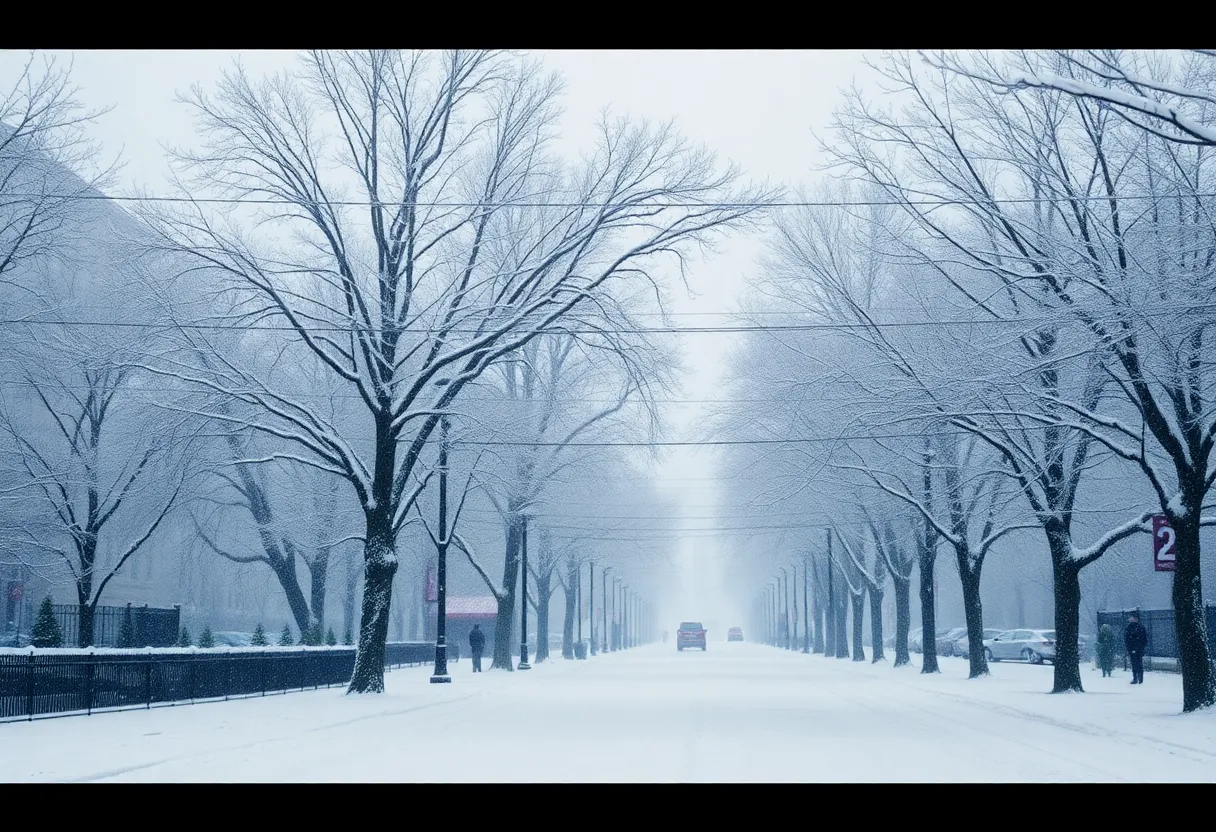
The D.C. area is preparing for a major winter storm bringing 1 to 4 inches of snow this Sunday, alongside icy conditions expected overnight. A winter weather advisory is active, with snowfall predicted to vary across regions. Residents are urged to stay updated on local forecasts and take precautions as travel conditions could deteriorate rapidly. Looking ahead, temperatures may drop significantly next week, making this one of the coldest spells in recent memory. City services like trash collection will also be affected due to the storm.
Winter Storm Alert Hits D.C. Area with Snow and Bitter Cold
Winter is making its presence felt as the D.C. area braces for a significant snow event. Folks in and around the nation’s capital should expect **_1 to 4 inches of snow_** to blanket the region on Sunday, creating what could be both a beautiful winter wonderland and a potential headache for travelers.
Winter Weather Advisory Active
A **_winter weather advisory_** is in place from **_7 a.m. until 7 p.m._** on Sunday. This alert entails a forecast of **_2 to 4 inches of snow_** for the immediate D.C. area, while northern Montgomery and western Loudoun counties are under a **_winter storm warning_**, predicting snowfall between **_3 to 6 inches_**. With different amounts forecasted, the highest snow totals are expected to hit areas north and west of the Beltway, making it vital to pay attention to local weather updates.
Rain to Snow Transition
Expect a bit of a mix in the morning as snow may start as rain in regions near and east of Interstate 95. By afternoon, things are expected to change, and snow coverage will increase, leading to deteriorating travel conditions. The worst of the travel issues will likely occur between midafternoon and early evening as **_visibility reduces and roads become slippery_** due to accumulating snow.
Icy Conditions Ahead
Adding to the woes, **_icy conditions_** are projected to develop Sunday night into Monday as any untreated wet or slushy spots freeze over. This means that commuters should be doubly cautious heading into the workweek.
Selectively Cold Week Promised
Looking ahead, next week could be one of the coldest spells in recent memory for the region. **_Wind chills_** are expected to plunge into the single digits early Monday, dipping below zero on Tuesday and Wednesday mornings. These frigid temperatures have also led officials to make adjustments, including moving the upcoming presidential inauguration indoors— a rare occurrence.
Snowfall Timing and Predictions
Snow is predicted to commence between **_7 a.m. and 9 a.m._** on Sunday, with the intensity tapering by early evening. While temperatures will hang around **_30 to 35 degrees_** before the snow starts, they may pose a challenge for accurate snow accumulation forecasts.
Preparedness is Key
Local snow crews are already hard at work, treating critical roads and ensuring plows are ready to tackle the impending snow. It has been rated as a **_Category 2 “disruptive” storm_** by Capital Weather Gang, indicating hazardous travel conditions are likely.
Impact on City Services
As a result of these conditions, residents should know that D.C. will not collect household trash or recycling on **_Martin Luther King Jr. Day_** due to the holiday and snow event. It’s a good idea to stay updated on service alterations, especially during such weather.
Stay Safe and Prepare
Residents are strongly encouraged to take necessary precautions during this extreme cold. If you need a place to keep warm, local shelters are available. As the snow descends and temperatures dive, ensuring your safety and comfort should be a top priority.
The forecast suggests we could see snow on the ground for much of the week, so gear up for a winter experience that’s going to stick around for a while!
Deeper Dive: News & Info About This Topic
- Washington Post: D.C. Snow and Cold Forecast
- Wikipedia: Winter Storm
- Fox 5 DC: Winter Storm Watches and Warnings
- Google Search: Winter Weather Advisory
- NBC Washington: Preparations for Snowstorm
- Google Scholar: Winter Storm Impact
- WUSA9: D.C. Prepares for Snow Storm
- Encyclopedia Britannica: Snow
- NBC Washington: Snow Expected in D.C. Area
- Google News: D.C. Snow Storm